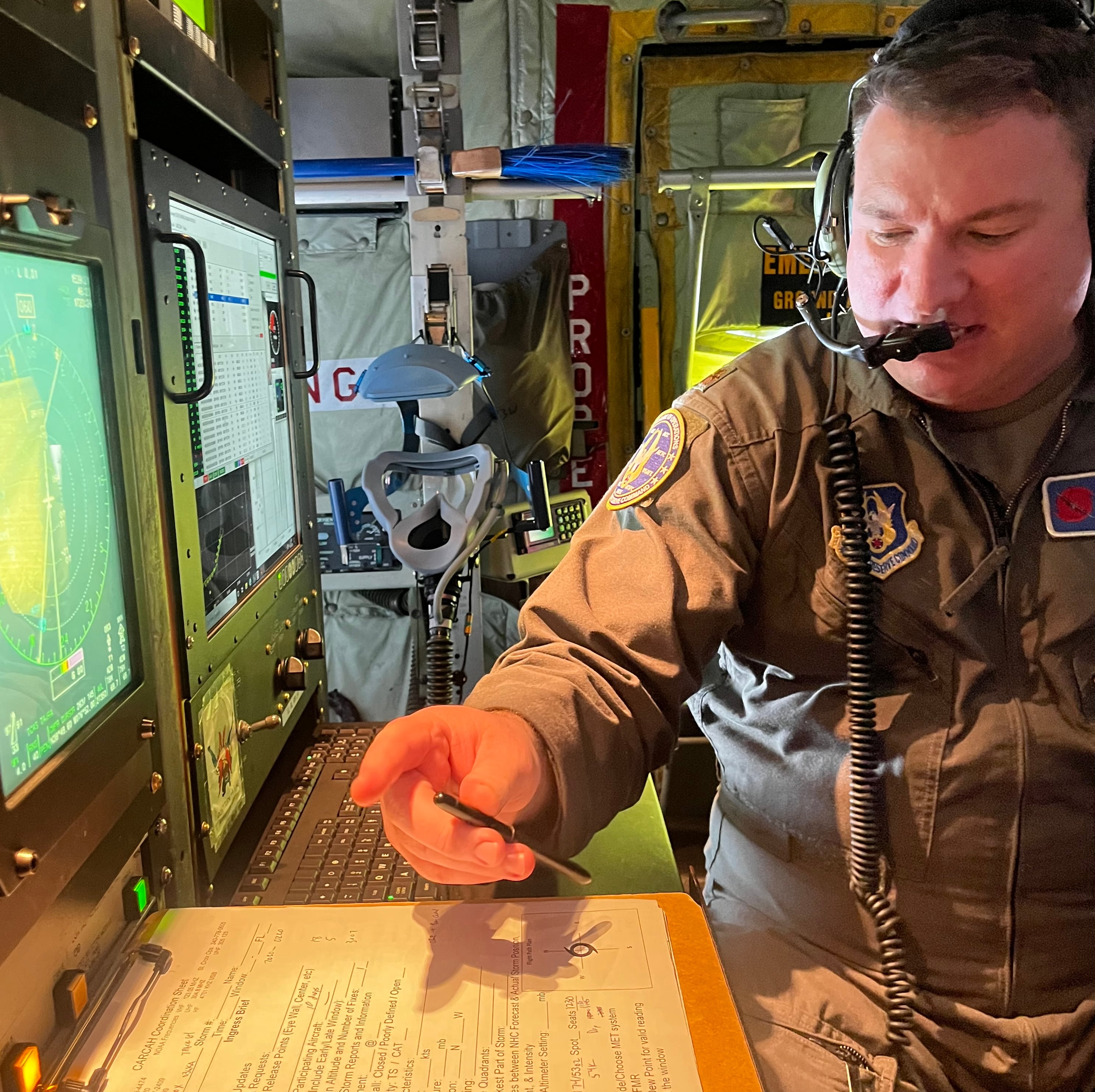
OVER THE ATLANTIC OCEAN — About 130 miles off the coast of Atlantic City, New Jersey, Master Sgt. Shawn Hogue grabs a tube from above his computer station in the belly of a WC-130J “Weatherbird” and launches it through a chute.
Falling from 23,000 feet, it takes the tube — called a dropsonde — about 10 minutes to hit the water. The instrument weighs less than a pound, and is the centerpiece of the day’s mission.
RELATED
Equipped with a small parachute, sensors, a microprocessor, radio transmitter and GPS gear, the dropsonde measures air temperature, the dew point, and wind speed and direction as it falls toward the ocean, sending data back to the aircraft along the way.
Hogue, the aircraft’s loadmaster, checks whether the information is coming in clean. He passes it to Maj. Chris Dyke, the mission’s aerial reconnaissance weather officer, or flying meteorologist, who sits a few feet away at a special computer where he analyzes information gathered by the dropsonde and other aircraft sensors, then transmits it to the National Hurricane Center in Miami.
In a real hurricane, the meteorologist would use the atmospheric data they collected to help direct the Weatherbird into the swirling storm.
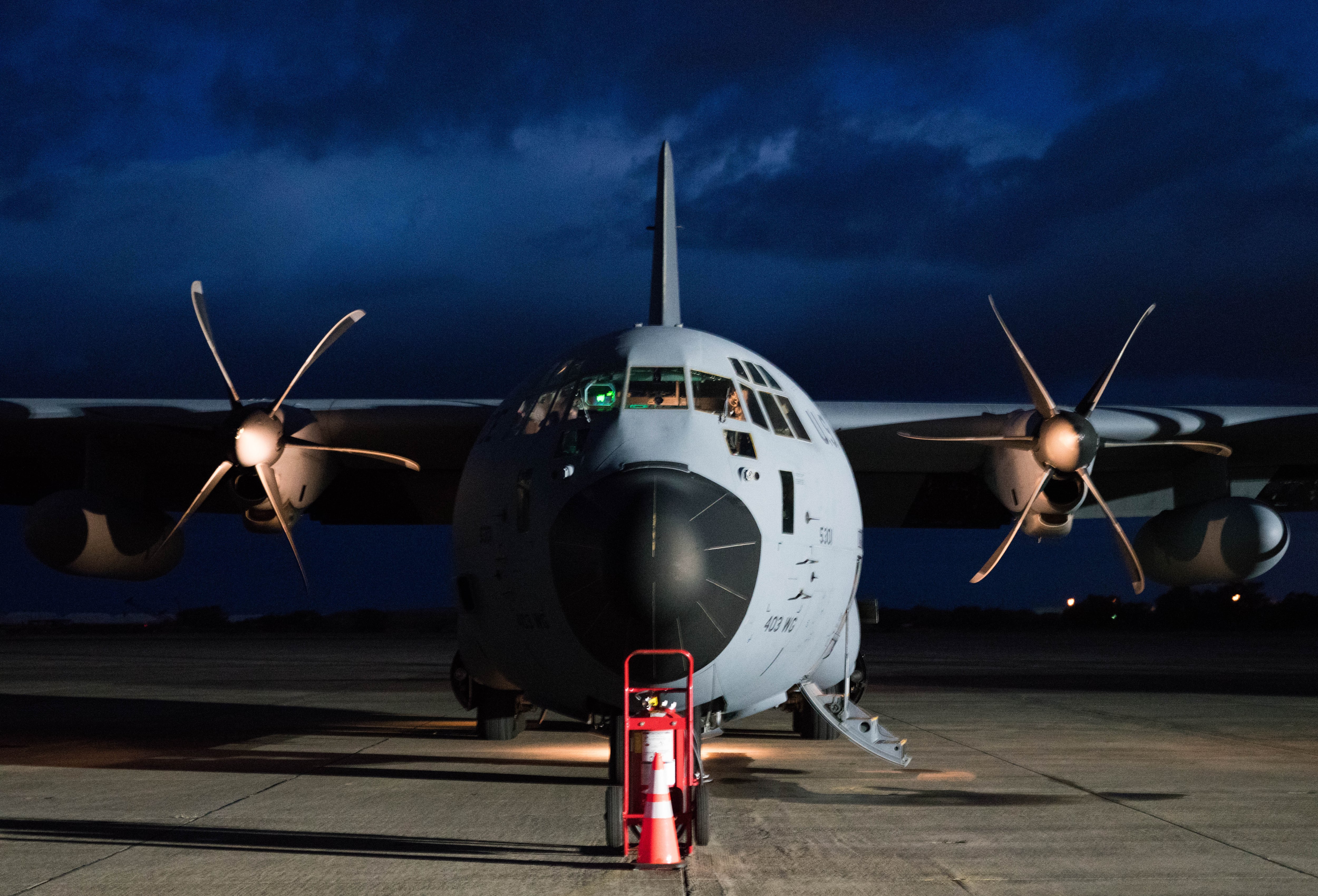
The crew from the 53rd Weather Reconnaissance Squadron, a reserve unit from Keesler Air Force Base, Mississippi, is preparing for hurricane season. Known as the “Hurricane Hunters,” the 53rd plays a critical role gathering data inside storms to help the NHC improve its forecasting.
“Like any good reconnaissance mission, our job is to create certainty out of uncertainty,” Dyke told reporters ahead of a demonstration flight along the East Coast on April 24.
Weathering the storm
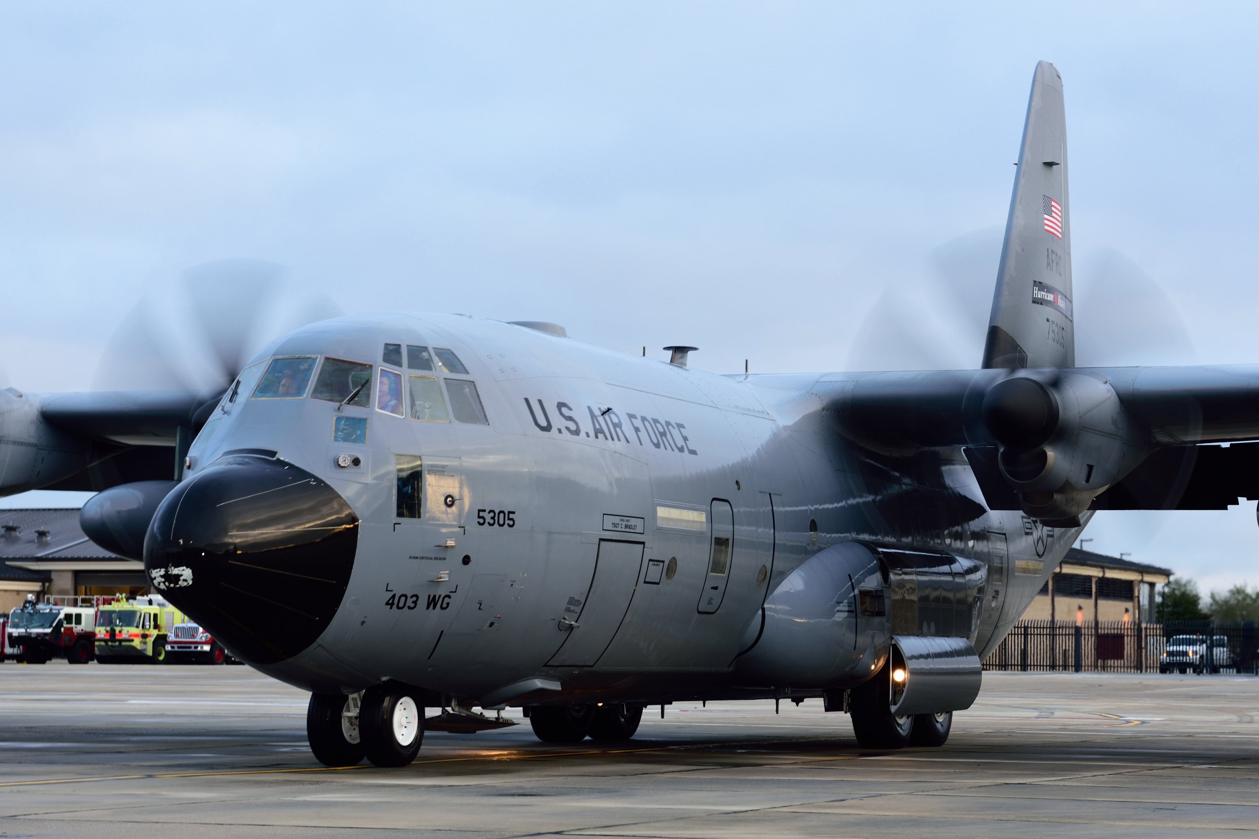
Comprised of 10 WC-130J aircraft loaded with weather-measuring equipment, the Hurricane Hunters are an exclusive Air Force mission. The unit was first established in 1943 and reactivated as part of the 403rd Operations Group at Keesler in 1993.
With 10 full-time and 10 part-time crews during hurricane season, which officially starts June 1 and runs through Nov. 30 each year, the 53rd can simultaneously fly in three separate storms from locations across the continental U.S., as well as from Hawaii and the Caribbean.
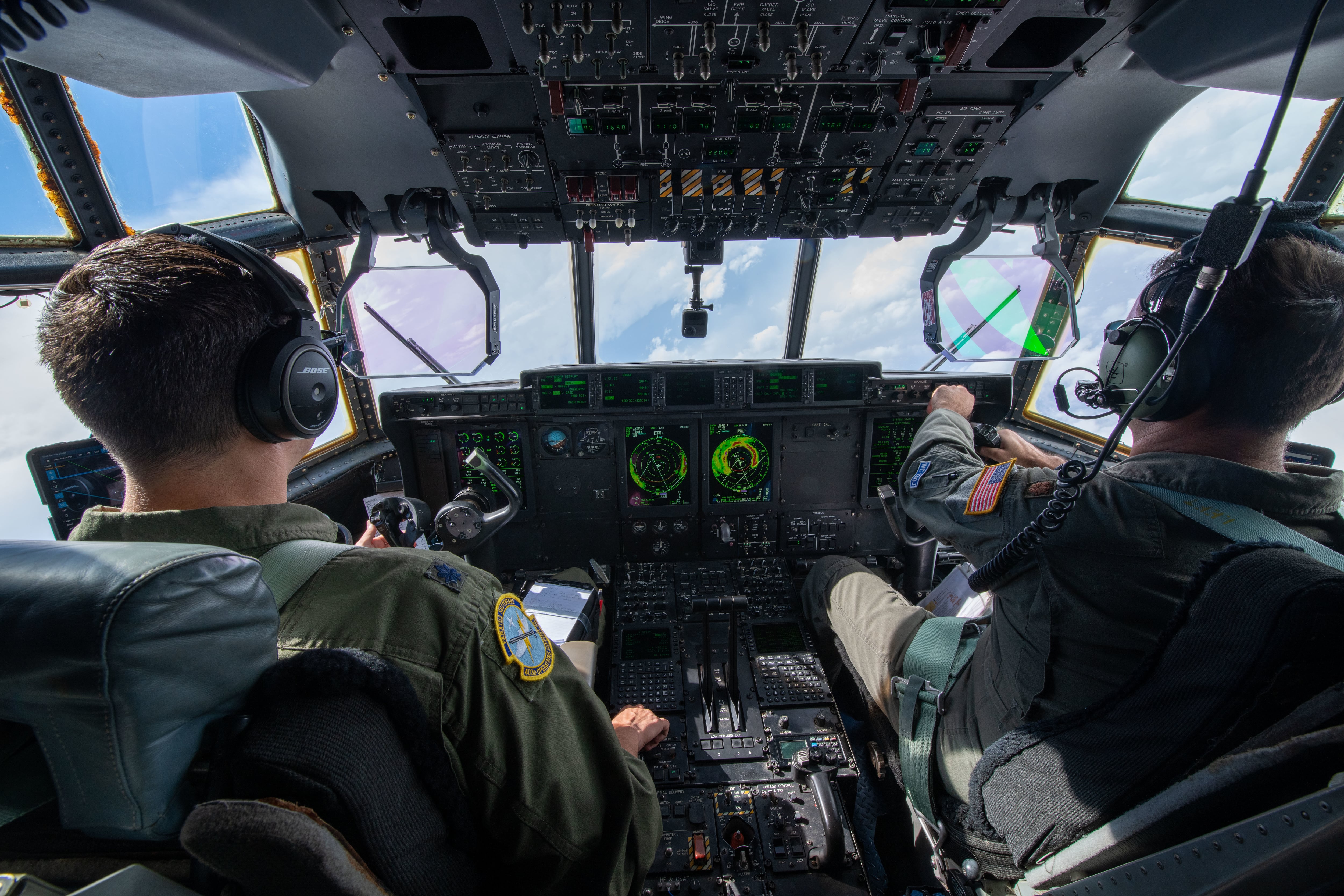
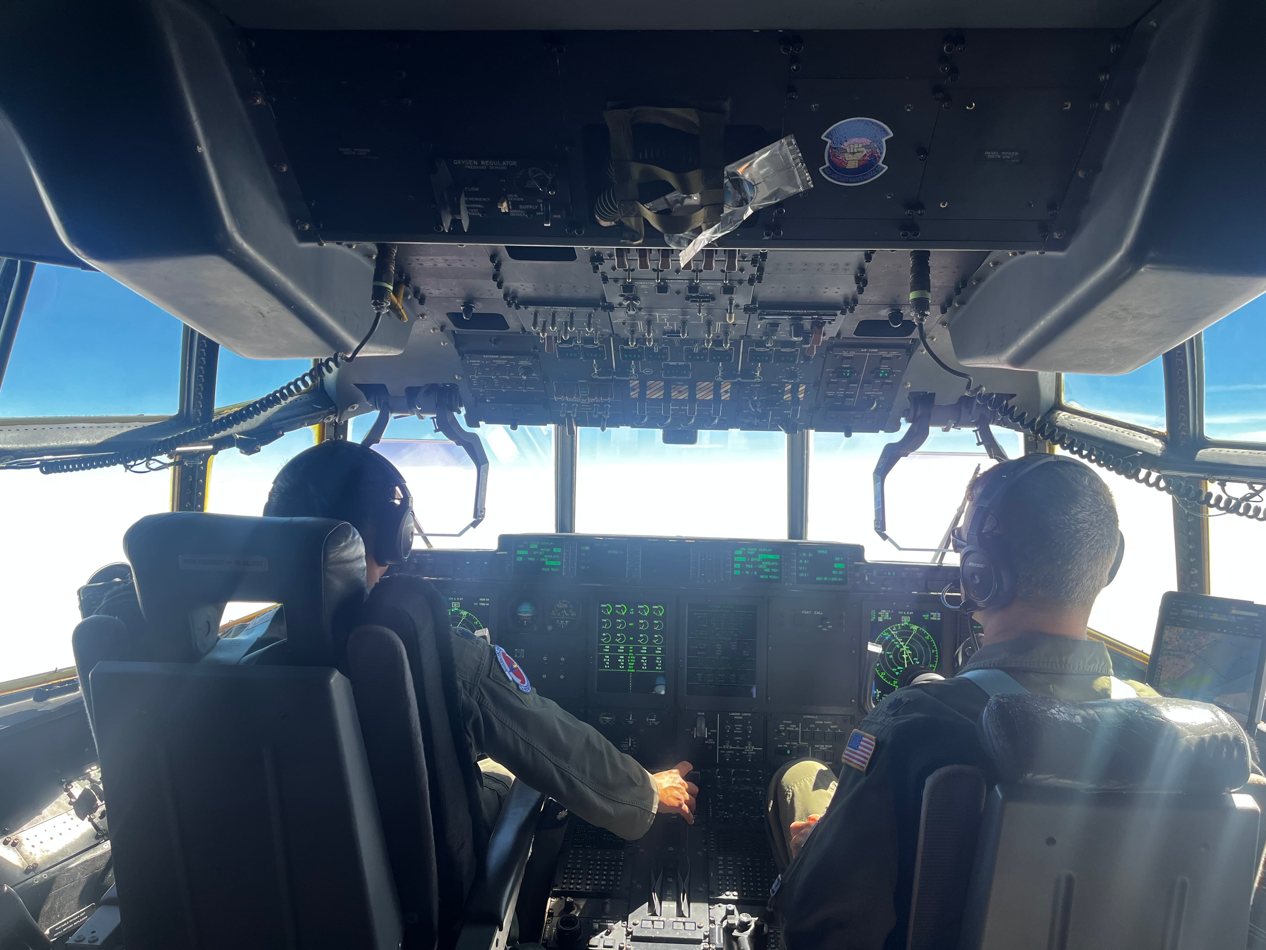
Five airmen work aboard each flight: two pilots, a navigator, an aerial reconnaissance weather officer and a loadmaster.
But the 53rd isn’t only on the hunt for hurricanes. Since 2020, crews now spend the winter tracking “atmospheric rivers,” or tropical winter storms that can dump massive amounts of rain or snow along America’s coasts.
The 53rd’s hunting has intensified as storms grow more frequent. Since 2018, the demand for winter reconnaissance flights has increased more than 600%. For hurricane season, it’s grown by 18%, according to the Air Force.
In fiscal year 2023, the Hurricane Hunters flew 93 tropical reconnaissance missions into 16 named storms, plus 48 missions during the winter.
RELATED
“Those are the highest we’ve had in the last nine years, at least,” Dyke said, adding that the volume of missions in 2024 is already on track to meet or beat last year — with about a month to go before hurricane season officially begins.
In April, forecasters at Colorado State University predicted the 2024 Atlantic hurricane season will become “extremely active” due to warm seawater and less wind shear to disrupt storms. CSU believes the season will generate five major hurricanes with winds above 111 mph, out of 11 hurricanes and 23 named storms in total.
Responding to more storms leaves less time to train and maintain the Hurricane Hunters’ aging fleet of aircraft, which averages almost 23 years old. The squadron completed its transition from the older C-130H to the WC-130J in 2005, and each aircraft has flown more than 6,500 hours on average, according to Air Force data.
“They are definitely spread thin,” Maj. Gen. C. McCauley von Hoffman, deputy chief of staff of the Air Force Reserve, told reporters. “At the same time, they would now be considered an aging weapons system, with the number of hours on it. So, parts availability, all of that, is hard.”
An aircraft that flies into a hurricane has unique maintenance needs as well, added Col. William Magee, commander of the 403rd Maintenance Group. Hail is one of the biggest culprits of damage, even though planes are painted to defend against it, he said.
After flying through Hurricane Ian, which made landfall in southwest Florida as a Category 4 storm in September 2022, maintainers had to replace several components on one aircraft, including its carbon-fiber propellers.
“Even though they’re modified to take that sort of hail damage, this one was so, so rough we had to change several propellers,” Magee said. “We had to change the radome.”
Taking into account the violent shaking that the aircraft endure as a result of hurricane-force winds, the corrosive environment they’re exposed to, and the pace of flights, the challenges of the Hurricane Hunters’ unique job are threatening to prove too much for the planes.
“I’m not authorized to say when enough is enough,” Magee said. “But we are growing our storm missions at a rate of … if you were to say, ‘Today is enough utilization of our airplanes,’ about every two years, we would earn another airplane to maintain that current utilization rate.”
Tight resources can mean making tough decisions. In August, the 53rd pulled aircraft from covering a storm out of St. Croix back to Keesler so they could fly in Hurricane Idalia, which made landfall in Florida as a Category 3 storm, Dyke said.
That could mean going without crucial data if a storm is prioritized over another.
“Now we’re talking about potential impacts to stateside readiness, homeland defense,” Dyke said. “If you ask the wing commander at Homestead [Air Reserve Base, Florida], the wing commander at Tyndall [AFB, Florida], the wing commander at any coastal installation, they’ll tell you the same thing. They rely on that hurricane center forecast to tell them what’s going to happen.”
Eyes on the storm
While the media flight in April saw mostly sunny skies, during an actual storm, the Hurricane Hunters launch multiple dropsondes from an altitude of about 10,000 feet, including at its eyewall and in the center, as directed by the flying meteorologist.
The Air Force says that data has helped improve the accuracy of hurricane forecasts by 20%, saving $1 million per mile of coastline. Flying in winter storms, too, has helped provide more predictive data, giving local and state officials more lead time to plan ahead on matters such as search-and-recovery efforts and when to lower water reservoirs to prevent flooding.
As the military and lawmakers increasingly worry about the effects of severe weather on military bases, the data collected by WC-130J crews can also help officials decide whether to evacuate people and assets like aircraft and ships.
Lt. Col. Stephen Pituch, the copilot on April’s demonstration flight, was the first to fly into Hurricane Michael in October 2018. Michael became the first Category 5 storm to hit the U.S. since Hurricane Andrew in 1992.
Michael advanced from a tropical storm to a Category 2 hurricane in less than eight hours, and within two days had roared into a Category 5, Pituch said. Tyndall may not have been evacuated had awareness of the storm’s intensity not been adequately gauged, he added.
Tyndall, as well as several other nearby military installations, evacuated thousands of personnel and some F-22 Raptor fighters. But the base was flattened by a direct hit from Michael, which by then had strengthened to a Category 4. The base is now more than five years into a reconstruction effort that is slated to cost about $5 billion.
“That was never forecast to be more than a Cat. 1,” Pituch said.
Courtney Mabeus-Brown is the senior reporter at Air Force Times. She is an award-winning journalist who previously covered the military for Navy Times and The Virginian-Pilot in Norfolk, Va., where she first set foot on an aircraft carrier. Her work has also appeared in The New York Times, The Washington Post, Foreign Policy and more.
